

How GPS-Guided Aquatic Harvesting is Transforming Your Lake's Ecosystem
 |

Summary:
GPS-guided aquatic harvesting is a precision management technique that uses satellite positioning and hydro-acoustic mapping to selectively remove nuisance vegetation from large lakes while protecting native habitats. Gone are the days of blindly cutting weeds; today's lake managers rely on real-time spatial data to target exact coordinates of invasive growth. By combining sophisticated software with traditional mechanical harvesting, we can ensure that every pass of the harvester maximizes efficiency and minimizes ecological disruption.
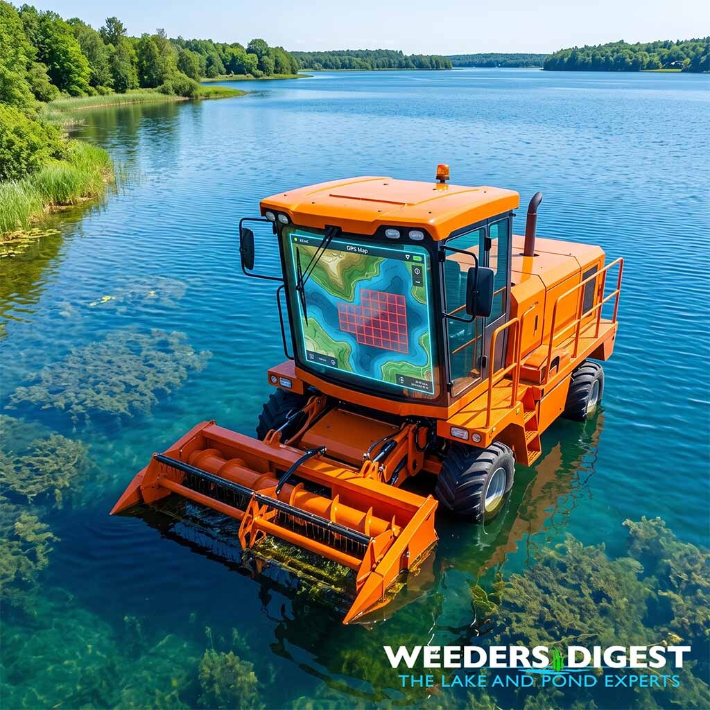
As a Certified Lake Manager, one of the most frustrating things I see in the field is a crew spending hours cutting a dense weed bed, only to realize later they drifted off course and accidentally cleared a vital nursery for native bass, while leaving a massive patch of invasive hydrilla untouched fifty yards away. Integrating a screen that displays live telemetry directly on the harvester's dashboard changes everything. You can watch the vessel track exactly over a pre-mapped "red zone" of invasive biomass, ensuring you are only cutting what needs to be cut and leaving the beneficial native plants intact.
This technology is not just about protecting the fish; it is about making large-scale lake management economically viable and environmentally sustainable. When managing waterbodies that span thousands of acres, efficiency is everything. Using GPS guidance allows managers to optimize their routes, reduce fuel consumption, and provide concrete data to lake associations and regulatory agencies proving that the harvesting operation achieved its specific ecological goals.
The Science Behind It:
The foundation of precision aquatic plant management relies on spatial sampling frameworks and the integration of Global Navigation Satellite Systems (GNSS), most commonly WAAS-enabled GPS (Wide Area Augmentation System). Before a harvester ever enters the water, limnologists conduct point-intercept surveys. In this method, a geo-referenced grid is superimposed over the bathymetric map (depth map) of the target waterbody. Using hydro-acoustic surveys—often employing 20-degree beam transducers integrated with GPS—scientists calculate the biovolume, which is the percentage of the water column occupied by plants. This data is post-processed in Geographic Information Systems (GIS) to create biovolume rasters, which serve as precise digital harvesting maps.
Once the mechanical harvester is deployed, it utilizes real-time GPS tracking to navigate these pre-determined grids. This is crucial for evaluating operational performance and ecological efficacy. In a comprehensive study conducted by the U.S. Army Corps of Engineers and the University of Florida on Lake Tohopekaliga, researchers wired GPS loggers directly to the ignitions of mechanical harvesters, recording spatial data at 10-second intervals over a total of 1,022 harvester-hours. This level of tracking allowed scientists to precisely measure efficiency, revealing an average daily harvest rate of 1.4 acres per boat-hour.
The telemetry data also exposes hidden inefficiencies in large-scale mechanical control. By analyzing the GPS track data from the Lake Tohopekaliga operations, researchers determined that approximately 25% of boat operations were spent not harvesting (U.S. Army Corps of Engineers, 2020). Instead, that time was consumed by transit, offloading, and maneuvering. By identifying these spatial bottlenecks, lake managers can strategically reposition offload barges or adjust harvest routes, significantly reducing non-harvesting time and lowering the overall carbon footprint of the management project.
Furthermore, precision harvesting mitigates the risk of extirpating (locally destroying) beneficial native flora. Aquatic plants undergo distinct zonation along depth gradients driven by light availability—a concept known as the photic zone. Invasive species like hydrilla (Hydrilla verticillata) or Eurasian watermilfoil (Myriophyllum spicatum) often form dense monotypic canopies that outcompete native species. By programming the GPS to strictly follow the coordinates of these invasive canopies, the mechanical harvester acts as a highly selective tool.
Post-management evaluation relies on comparing the pre-treatment GPS data against post-treatment hydro-acoustic scans. This allows ecologists to calculate critical limnological metrics, such as shifts in the maximum depth of plant colonization and the frequency of occurrence for specific target species. A statistically significant reduction in the target species' frequency of occurrence, coupled with a stable native species diversity index, confirms that the GPS-guided intervention successfully reset the ecological balance without causing unintended collateral damage to the lake's broader ecosystem.
Sources / References:
- https://corpslakes.erdc.dren.mil/employees/learning/webinars/20Jun17-MECHANICAL-HYDRILLA.pdf (U.S. Army Corps of Engineers & University of Florida IFAS, Operational Performance of Hydrilla Harvesting on Lake Tohopekaliga)
- https://blogs.ifas.ufl.edu/caip/2022/08/03/lakes-from-space-using-technologies-to-enhance-aquatic-plant-management-precision-and-accuracy/ (UF/IFAS Center for Aquatic and Invasive Plants, Lakes From Space: Using Technologies to Enhance Aquatic Plant Management Precision and Accuracy)
- https://www.researchgate.net/publication/315114678_A_review_of_aquatic_plant_monitoring_and_assessment_methods (ResearchGate, A review of aquatic plant monitoring and assessment methods)