

How I Use Next-Generation Hydro-Acoustics to Scan Biomass Density Under Your Lake's Surface
 |

Summary:
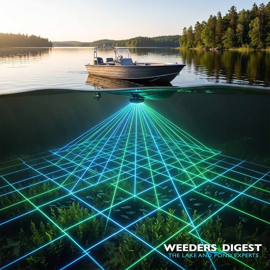
Next-generation hydro-acoustics is a high-tech sonar method used to accurately measure the volume, density, and location of aquatic plants and fish suspended beneath the surface of a lake or pond. By sending targeted sound pulses into the water column and interpreting the returning echoes, lake managers can generate highly detailed, three-dimensional maps of submerged life without ever having to drain the water or manually pull up weeds. This technology essentially acts as an underwater ultrasound, translating invisible aquatic jungles and fish schools into clear, actionable, and measurable data.
Just last month, while mapping a 50-acre community pond that was suffering from persistent dissolved oxygen issues, visual surface inspections suggested only a mild weed problem along the shoreline. However, once I fired up the hydro-acoustic transducer on the survey boat, the digital biovolume map revealed massive, dense beds of invasive hydrilla choking out the bottom—completely invisible from the surface, yet single-handedly driving the lake's nutrient imbalance. Field insights like this demonstrate why relying on the naked eye is no longer sufficient for modern aquatic management.
For homeowners and property managers, this means the guesswork of treating aquatic weeds or stocking fish is completely eliminated. Instead of blindly pouring expensive treatments into the water or guessing the extent of a weed infestation, this sonar technology allows for precision targeting. It protects the ecological balance by ensuring treatments are only applied exactly where they are necessary, ultimately saving both time and money while fostering a significantly healthier aquatic environment.
The Science Behind It:
Hydro-acoustics utilizes scientific echosounders that transmit acoustic energy into the water column and record the returning backscatter, which is the echo reflected off objects possessing a density different from the surrounding water. When these sound waves encounter the gas-filled swim bladders of fish or the distinct cellular structures of submerged aquatic vegetation, a portion of the acoustic energy is scattered back to the transducer. The intensity of this returning signal, known as target strength, combined with the acoustic cross-section, allows limnologists to quantify the physical size and spatial distribution of underwater biomass. By processing this acoustic backscatter through specialized algorithms, researchers can mathematically differentiate between the soft muddy bottom of a lake, the dense canopy of a macrophyte bed, and suspended pelagic fish populations.
The accurate calculation of macrophyte biovolume—defined ecologically as the percentage of the water column occupied by plant material—is a primary application of this technology in modern lake management. Traditional methods of assessing aquatic vegetation, such as point-intercept surveys using double-sided rakes or SCUBA quadrat sampling, are highly subjective, labor-intensive, and prone to severe spatial errors. In contrast, hydro-acoustic mapping provides continuous, high-resolution spatial data. A pivotal study published in the Canadian Journal of Fisheries and Aquatic Sciences comparing these methods at Devils Lake, Oregon, found that hydro-acoustic surveys yielded exceptionally low coefficients of variation for plant bed biovolume estimates, ranging from 0.05 to 0.18. This high precision provided a 5- to 18-fold greater capability to detect changes in the mean aquatic habitat compared to concurrent SCUBA quadrat sampling, which exhibited massive coefficients of variation ranging from 0.81 to 1.05.
Furthermore, next-generation hydro-acoustics serves as a vital non-destructive tool for evaluating fish stock density and distribution, particularly in deep, stratified aquatic ecosystems. Fisheries biologists utilize the Nautical Area Scattering Coefficient to measure the total acoustic backscatter of a fish aggregation, which is then converted into absolute biomass estimates. For example, peer-reviewed research evaluating the density and biomass of mono- and polymorphic Coregonus (whitefish) populations in subarctic lakes demonstrated the high efficacy of this method in pelagic zones. The hydro-acoustic assessments revealed that the pelagic density of densely rakered whitefish morphs varied significantly, ranging from 330 to 1,780 fish per hectare, with an estimated biomass of 1.4 to 13.3 kilograms per hectare. These precise volumetric measurements would be practically impossible to calculate on a lake-wide scale using traditional, lethal gill-netting techniques alone.
Advancements in cloud-based algorithmic processing and dual-frequency transducers have further refined the resolution of hydro-acoustic data, mitigating historical challenges such as acoustic shadowing, a phenomenon where dense plant canopies block sound waves from reaching the lake bottom. High-frequency pings provide the ultra-fine resolution required to map delicate macrophyte architectures, while lower frequencies are optimized for penetrating deeper waters to assess demersal fish habitats. By integrating this acoustic data with Environmental DNA sampling and real-time GPS telemetry, aquatic ecologists can now generate highly accurate, species-specific biomass models that dictate precise ecological interventions.
Sources / References:
- https://cdnsciencepub.com/doi/10.1139/f90-093 (Estimation of Submergent Plant Bed Biovolume using Acoustic Range Information - Canadian Journal of Fisheries and Aquatic Sciences)
- https://www.researchgate.net/publication/259548680_Hydroacoustic_assessment_of_mono-_and_polymorphic_Coregonus_density_and_biomass_in_subarctic_lakes (Hydroacoustic assessment of mono- and polymorphic Coregonus density and biomass in subarctic lakes)