

How Shifting Ice Sheets Naturally Redesign Our Shorelines Over Twenty Years
 |

Summary:
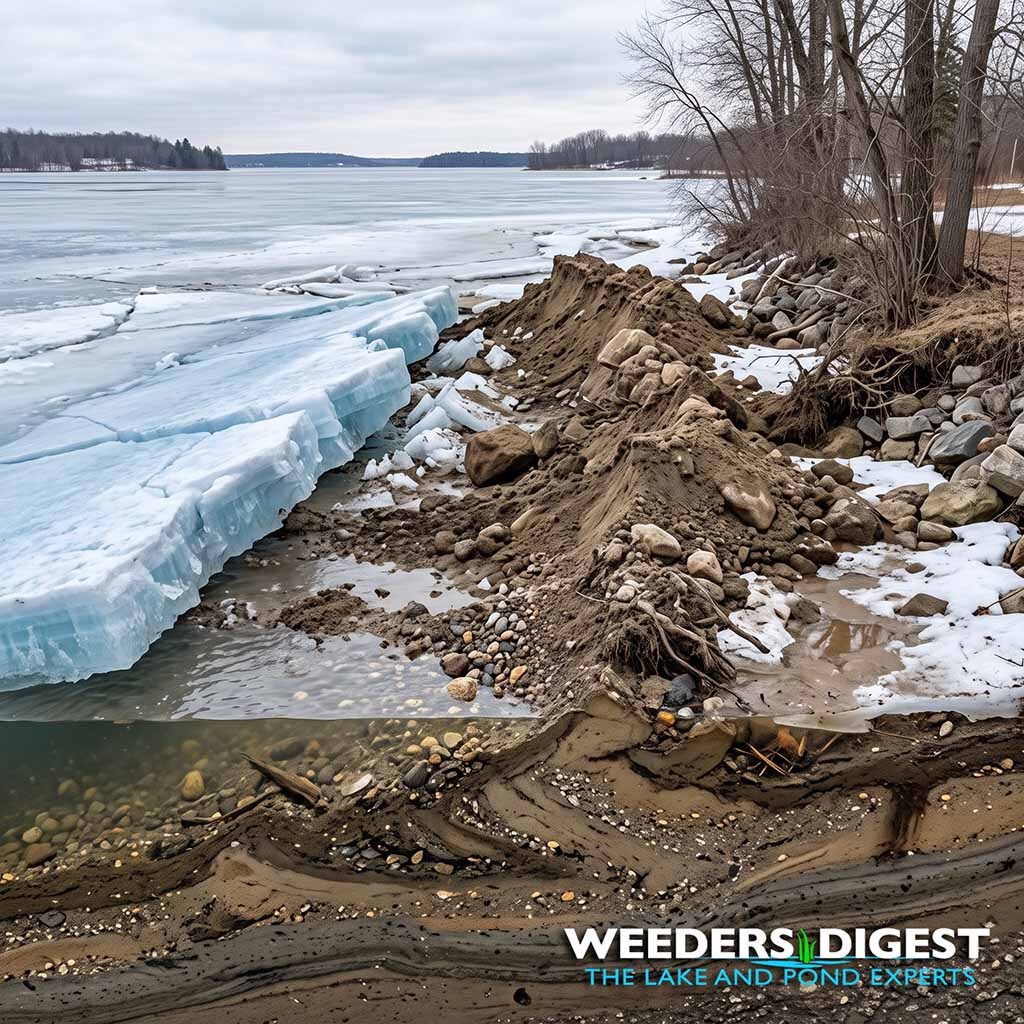
Shifting lake ice naturally redesigns our shorelines over a twenty-year period through repeated cycles of thermal expansion, ice jacking, and wind-driven ice shove that displace tons of subaqueous sediment, bulldoze littoral substrate inland, and construct pronounced geological mounds known as ice ramparts. While a single mild winter might only nudge minor pebbles, two decades of freeze-thaw extremes relentlessly reshape the lakebed profile, altering nearshore bathymetry and shifting natural vegetation lines. We see this firsthand every spring when our lake experts evaluate waterfront properties: homeowners often find that their gently sloped sandy beaches have developed sudden ridges, their riprap has been pushed yards upland, and shallow nearshore zones have filled with loose, trapped muck and organic debris gouged loose by sheet movement. Over twenty continuous seasons, these localized disturbances accumulate into permanent littoral berms, creating natural dams that trap stagnant water, smother root systems, and trap incoming storm runoff.
The Science Behind It:
The morphological restructuring of a lake shoreline by seasonal ice cover is driven by two primary physical mechanisms: thermal expansion (often culminating in ice jacking) and hydrodynamic wind action driving late-season ice shoves. Ice has a coefficient of linear thermal expansion of approximately 0.00005/°C. In temperate lacustrine environments spanning large basins—such as an unconstrained lake spanning 4 kilometers across—a sudden 20°C temperature elevation across an intact ice sheet produces a theoretical expansion of roughly 4 linear meters:
ΔL = α · L · ΔT = (5.0 × 10⁻⁵ /°C) · (4.0 × 10³ m) · (2.0 × 10¹ °C) = 4.0 × 10⁰ m (or 4 m)
When temperatures plummet rapidly, the sheet contracts and develops vertical tension fractures. Lake water wells into these open fissures and promptly freezes, enlarging the continuous mass of the sheet. When ambient temperatures subsequently recover, the newly widened ice cannot fit within its original basin confines. The expanding sheet expends its compressive kinetic force against the weak resistance of the littoral zone, exerting lateral pressures that routinely exceed 100 to 300 kilopascals against the shoreline margin.
Over a twenty-year timeline, this annual thermal jacking acts like a low-frequency, ratcheting conveyor belt. The basal ice sheet freezes directly into the subaqueous littoral bench—incorporating cobble, sand, and fine silt directly into its lower matrix. As thermal expansion or late-spring wind gusts (exceeding 30 to 45 knots during breakup) propel fractured pan ice onto the shore, the sheet functions as a natural bulldozer. It gouges out the benthic littoral shelf and piles loose lacustrine sediments into linear mounds termed "ice ramparts" or ice-push ridges, which over 20 consecutive winters can accumulate to heights of 1 to 2 meters above baseline mean high water.
Furthermore, this multi-decade shoreline deformation profoundly reshapes local nearshore hydrodynamics. The excavation of benthic sediments directly lakeward of the ice rampart creates scour troughs, while the pushed berm acts as a physical dike against terrestrial runoff. Over 20 years, these physical alterations isolate shallow littoral pockets, reducing natural wave exchange, promoting localized thermal stratification, and dramatically increasing the retention of decaying macrophyte material and organic sediment in the immediate swim zone.
Our Recommendation for Managing Shoreline Ice & Sediment Redistribution:
When shifting winter ice sheets repeatedly dredge benthic sediments and churn up the nearshore substrate, the resulting shoreline pockets become prime catchment areas for loose, decomposing muck and silt. Left unmanaged, these stagnant depressions fuel explosive spring weed growth and foul the lake bottom.
To break this cycle, the shoreline requires continuous hydrodynamic flow to prevent loose displaced silt and settling organic solids from anchoring into deep muck layers. Scientifically, the most effective way to maintain clean nearshore bathymetry is through automated, continuous directional water velocity. We recommend installing an active directional water flow system—such as our AquaThruster Muck & Weed Blower collection—which creates sweeping laminar water currents along the lake floor to continuously displace loose silt, prevent stagnation in post-ice scour zones, and restore a firm, clean lake bottom throughout the open-water season.
Sources / References:
- Alberta Environment and Protected Areas / Respect Our Lakes Program: Understanding Ice Ridges and Ice Pushes (https://grouper-jaguar-zj4x.squarespace.com/s/RespectOurLakes-Ice-Ridges.pdf)
- Environment and Climate Change Canada: Sea Ice Cycle: Deformation, Thermal Expansion, and Pressure Ridges (https://www.canada.ca/en/environment-climate-change/services/ice-forecasts-observations/publications/sea-cycle/chapter-3.html)
- Frontiers in Earth Science & MDPI Water: Impact of Ice Dynamic Processes and Hydraulic Regimes on Lacustrine and Riverine Morphology (https://www.mdpi.com/2076-3417/15/18/10270)