

My Guide to Drone Mapping: Transforming Your Lake's Weed Identification with Multispectral Imaging
 |

Summary:
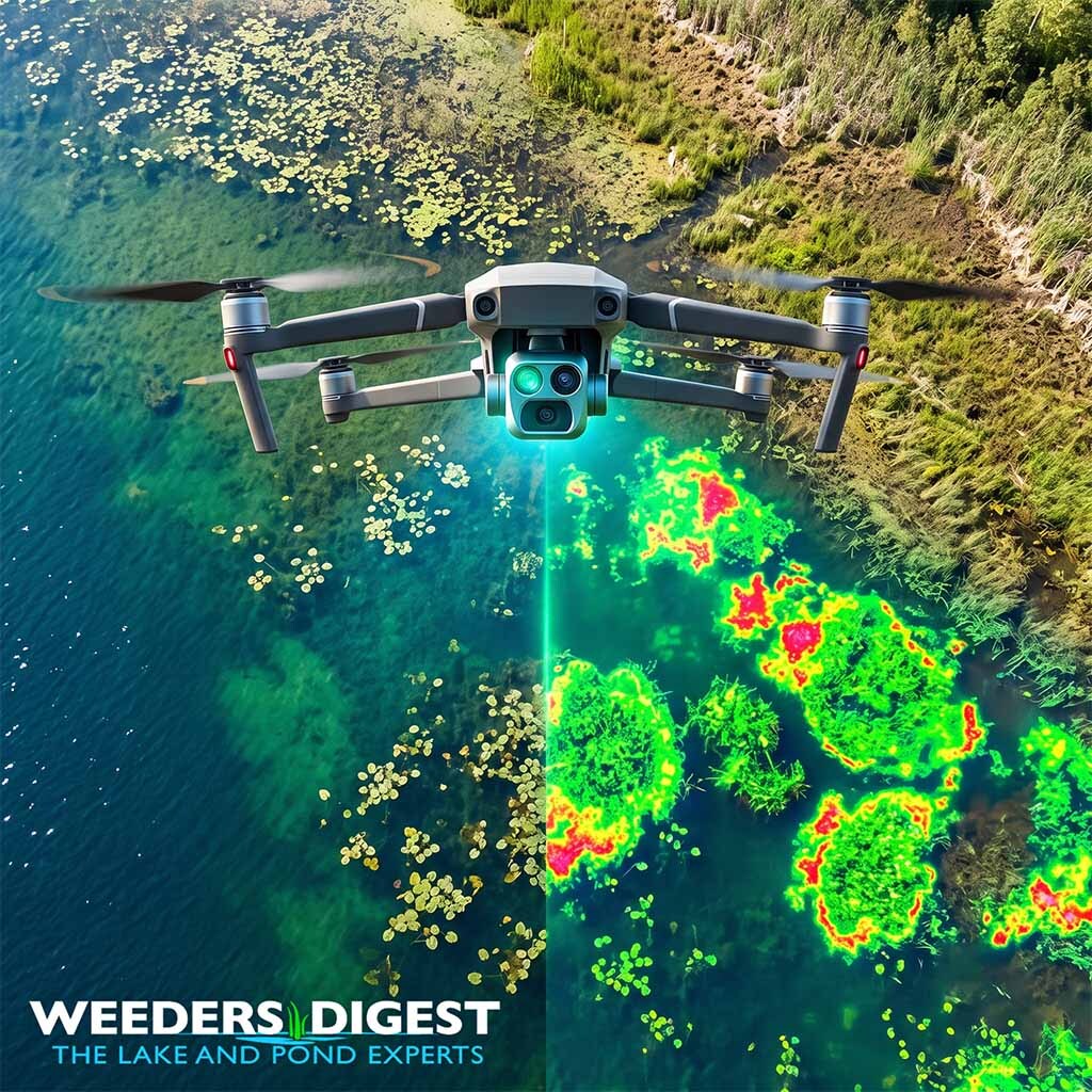
Drone mapping equipped with multispectral imaging is an advanced remote sensing technique that identifies and maps aquatic weed species by capturing specific wavelengths of light reflecting off plant surfaces. Instead of just taking a standard photograph, these specialized drone cameras look at colors of light that our human eyes cannot even see. Every type of plant reflects a unique signature of sunlight, much like a fingerprint. By reading these invisible light patterns, the drone can tell exactly where a harmless native plant ends and an aggressive invasive weed begins, even when they are mixed together in the same patch of water.
This technology completely changes how we approach waterbody maintenance, shifting the process from guesswork to precise, targeted action. In my years working on the water as a Certified Lake Manager, I used to rely on tossing a weed rake from an aluminum boat and estimating the extent of an infestation based on what I dragged up. Now, flying a multispectral drone overhead allows me to instantly cut through the surface glare and see the exact footprint and density of an invasive species hidden just below the surface. This means we can map the entire lake in a fraction of the time, treating only the problem areas without disturbing the healthy, native ecosystems.
Because the drone captures such highly detailed information, it gives lakefront homeowners and environmental teams a clear, undeniable picture of the water's health. The resulting maps act as a blueprint for the season's management plan. Instead of blanketing an entire cove with broad treatments or heavy harvesting equipment, we can deploy resources exactly where they are needed most. This targeted approach not only saves time and money, but it dramatically reduces the environmental impact on your lake, keeping the water safe, clean, and balanced for everyone to enjoy.
The Science Behind It:
Multispectral imaging relies on sensors that capture image data within specific wavelength ranges across the electromagnetic spectrum, including visible light (Red, Green, Blue) and invisible radiation, such as Near-Infrared (NIR) and Red Edge. Aquatic macrophytes and emergent vegetation contain chlorophyll, which absorbs visible red and blue light for photosynthesis while heavily reflecting near-infrared radiation. By measuring the contrast between the absorbed visible light and the reflected infrared light, limnologists can calculate specific vegetation indices. The most common of these is the Normalized Difference Vegetation Index (NDVI), a quantitative metric that isolates active, healthy plant biomass from surrounding variables like bare soil or open water.
Applying these spectral indices to aquatic environments requires isolating the vegetation from the highly reflective and absorptive nature of the water column. A 2020 study published in Remote Sensing analyzed aquatic plant detection in small reservoirs using Unmanned Aerial Vehicle (UAV) multispectral imagery. The researchers found that emergent, waterside plants exhibited their highest reflectance in the Near-Infrared band, whereas floating aquatic plants had a higher reflectance in the Red Edge band. The study concluded that NDVI and the Green Normalized Difference Vegetation Index (GNDVI) provided the clearest mathematical differentiation between aquatic plants and the water surface, making them the most effective indices for accurately mapping aquatic habitats.
To translate these complex spectral signatures into actionable species identification, modern aquatic ecology frequently integrates deep learning algorithms. Deep Convolutional Neural Networks (DCNN) can be trained to recognize the distinct spectral and textural patterns of specific weed biotypes. A 2022 study published in Frontiers in Plant Science demonstrated this capability by fusing high-resolution RGB imagery with multispectral data. By processing this fused remote sensing data through a DCNN, researchers achieved field identification accuracies of 81.1% for barnyardgrass and 92.4% for velvetleaf, proving that machine learning paired with multispectral phenotyping can thoroughly map dynamic weed populations in real-world agricultural and aquatic environments.
The precision of this technology also extends to highly heterogeneous ecosystems, such as moving streams and mixed-vegetation wetlands. Research conducted at the University of Kentucky applied multispectral UAV imagery to classify and map aquatic vegetation in shallow stream corridors. The classification algorithms yielded high overall accuracies of 83.73% in validation datasets when distinguishing floating species like duckweed from riparian vegetation and open water. However, the study noted that while surface and emergent mapping was highly accurate, submerged aquatic vegetation, such as benthic algae, remained mathematically difficult to segment due to the rapid attenuation of infrared wavelengths as they travel downward through the water column.
Ultimately, integrating multispectral UAV remote sensing into aquatic biology replaces historically subjective, point-based manual sampling with continuous, high-resolution geospatial data. While the optical physics of the water column still present limitations for deep-water benthic mapping, the application of targeted vegetation indices and machine learning classification represents a significant leap forward in ecological monitoring. It provides a highly accurate, non-invasive mechanism for identifying invasive species spread, assessing ecosystem health, and establishing quantitative baselines for long-term limnological management.
Sources / References:
- https://www.frontiersin.org/journals/plant-science/articles/10.3389/fpls.2022.938604/full
- https://www.researchgate.net/publication/338850158_Detection_of_Aquatic_Plants_Using_Multispectral_UAV_Imagery_and_Vegetation_Index
- https://uknowledge.uky.edu/context/bae_etds/article/1090/viewcontent/Agioutanti_Thesis_Final_Corrected_Ford.pdf