

Your Lake's Future: How I Use Advanced Technologies for Better Water Management
 |

Summary:
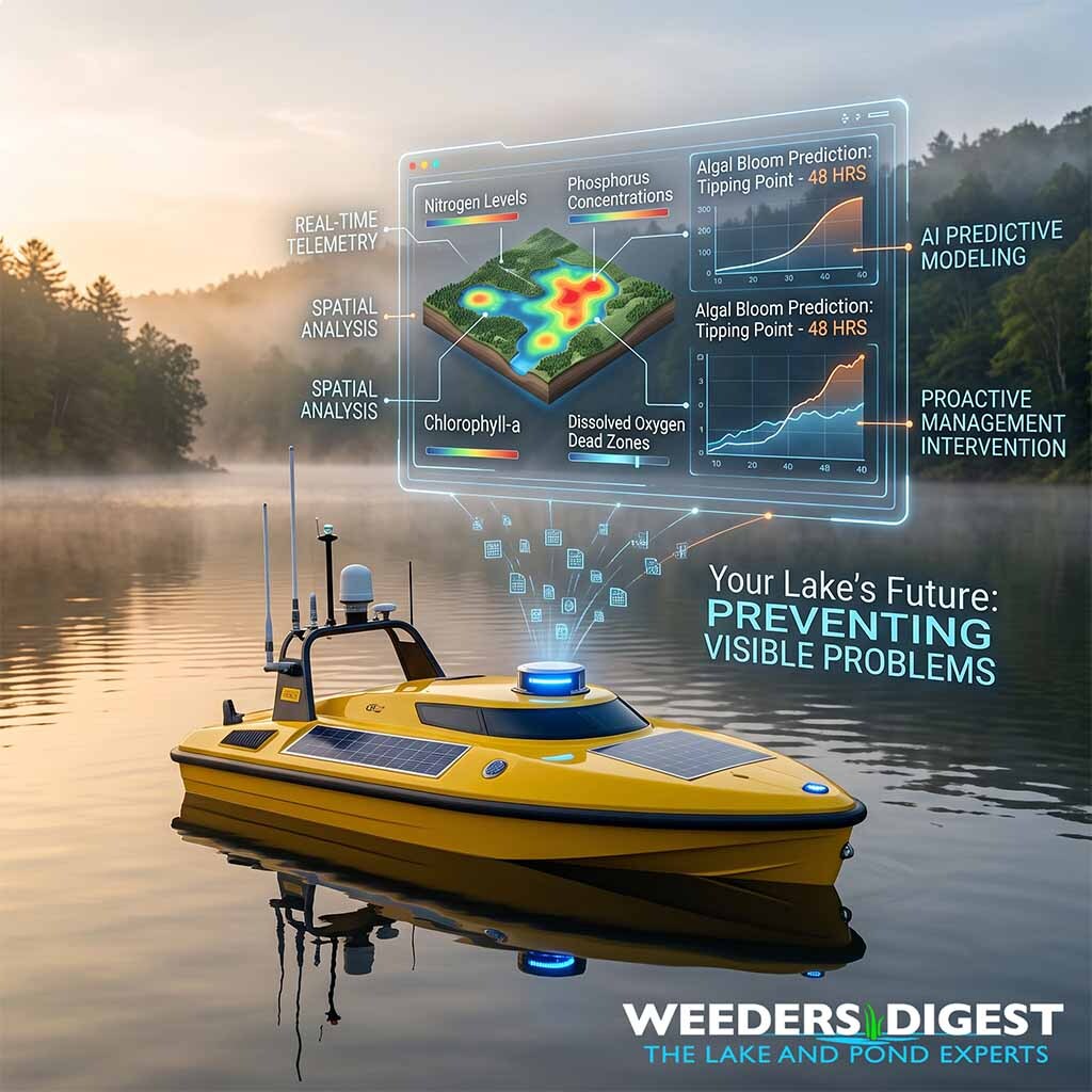
The future of lake and pond management relies on integrating autonomous surface vehicles, artificial intelligence predictive modeling, and remote real-time sensors to preemptively stop water quality issues before they visually manifest. For decades, the aquatic industry standard has been highly reactive—waiting for a massive algae bloom to surface, invasive weeds to take over, or fish to die off before mobilizing treatments. Now, we are shifting toward a proactive model where smart technology actively monitors the aquatic ecosystem around the clock, giving professionals the exact data needed to intervene with pinpoint accuracy.
During my routine work as a Certified Lake Manager, I used to spend hours manually collecting water samples from the back of an aluminum boat, only to wait days for laboratory results while a toxic algae bloom rapidly choked out a community pond. Today, field observations look entirely different. I can deploy an Unmanned Surface Vehicle (USV) equipped with continuous telemetry, pull up a mobile dashboard, and instantly map out dissolved oxygen dead zones and chlorophyll spikes across a 500-acre lake. This real-time visibility allows us to spot microscopic nutrient shifts and treat a specific half-acre bay days before a shoreline resident ever sees a green film on their water.
Ultimately, these emerging technologies mean less chemical dependency, lower long-term management costs, and healthier aquatic ecosystems for your local waterways. By removing the guesswork from lake maintenance, homeowners and lake associations can transition from constantly fighting aquatic imbalances to simply enjoying their beautifully clear shorelines.
The Science Behind It:
Modern aquatic ecosystem management is currently undergoing a paradigm shift driven by the integration of the Internet of Things (IoT), artificial intelligence (AI), and autonomous telemetry. At the core of this transition is the move away from localized spot-sampling toward continuous, high-resolution geospatial data collection. Unmanned Surface Vehicles (USVs) and smart buoy networks are now deployed to measure critical biogeochemical parameters—such as dissolved oxygen (DO), pH, specific conductance, and chlorophyll-a (a primary indicator of algal biomass)—across continuous spatial and temporal scales. According to research on the use of USVs in water chemistry studies published by the Hellenic Centre for Marine Research, these autonomous systems effectively map spatial fluctuations of harmful parameters in real-time, eliminating the spatial bias and lag times inherent in traditional labor-intensive laboratory sampling.
The continuous influx of ecological data collected by these surface vehicles is subsequently processed using advanced machine learning algorithms to predict future aquatic events. Eutrophication, a biological process where excessive nutrient loading leads to explosive aquatic plant and algae growth, is a primary driver of lake degradation. Recent environmental market research from Dataintelo indicates that freshwater nutrient levels, specifically nitrogen and phosphorus, have increased by 41% globally over the past two decades. To combat this aggressive nutrient loading, researchers are successfully utilizing AI frameworks, such as linear regression models and Bidirectional Encoder Representations from Transformers (BERT), to analyze real-time sensor data and forecast ecological tipping points.
Predictive modeling fundamentally alters the remediation timeline for Harmful Algal Blooms (HABs) and dissolved oxygen crashes. A study published in the International Journal of Novel Research and Development (IJNRD) on AI-driven water management systems demonstrated that IoT-based lake monitoring frameworks can predict water dynamics with a highly reliable error rate of below 10%. By processing variables like barometric pressure, turbidity, and temperature gradients, these neural networks detect the invisible preconditions of an ecological crash. Instead of reacting to a biological collapse, the algorithms allow managers to automatically trigger localized aeration protocols or precise biological augmentations to stabilize the water column.
Furthermore, remote sensing technologies utilizing multispectral satellite imagery and Synthetic Aperture Radar (SAR) are providing macro-level insights into watershed-wide dynamics. These orbital sensors detect thermal pollution, structural shoreline degradation, and widespread cyanobacteria concentrations that localized sensors might miss. When combined with localized USV data, this creates a comprehensive digital twin of the lake ecosystem that allows researchers to view both the micro and macro biological functions of the waterbody simultaneously.
By utilizing these multi-modal AI components, policymakers, environmental agencies, and lake technicians can allocate resources with unprecedented efficiency. Instead of applying broad-spectrum treatments to an entire waterbody—a practice that can disrupt non-target species and the benthic macroinvertebrate community—interventions can be deployed using precise, GPS-guided variable rate applications. This data-driven precision significantly mitigates the ecological footprint of lake management, ensuring the sustainable, long-term preservation of freshwater habitats.
Sources / References:
- "Use of Unmanned Surface Vehicles (USVs) in Water Chemistry Studies" - Hellenic Centre for Marine Research (ResearchGate)
- URL: https://www.researchgate.net/publication/380199259_Use_of_Unmanned_Surface_Vehicles_USVs_in_Water_Chemistry_Studies
- "Predictive Modelling for Groundwater Detection and Management Using AI and ML" - International Journal of Novel Research and Development (IJNRD)
- URL: https://ijnrd.org/papers/IJNRD2504287.pdf
- "Global Lake Management Market Research Report 2034" - Dataintelo
- URL: https://dataintelo.com/report/global-lake-management-market