

Reading the Depths: How I Use Underwater Maps to Uncover My Lake’s Hidden History

Summary:
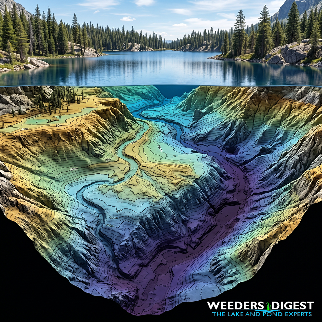
Every time I look out over a lake, I am reminded that the water’s surface is just a veil hiding a complex and ancient landscape. To the casual observer, a lake is a flat expanse of blue, but beneath that surface lies a rugged world of drowned river valleys, ancient shorelines, and submerged hills. By using underwater topography maps—also known as bathymetric maps—I can essentially peer through the water to see the true shape of the lake basin. These maps are the blueprints of a lake's past, revealing the secrets of how it was formed thousands of years ago.
Understanding the "lay of the land" underwater tells us a story that isn't visible from the shore. Deep, steep-sided trenches might point to the path of a retreating glacier, while gentle, shallow slopes might indicate areas where sediment has been washing in for centuries. For a homeowner or a curious explorer, these maps transform a mysterious body of water into a familiar landscape. They show us where the old creek beds used to run before a dam was built or where ancient forests once stood before the basin was filled.
Mapping this underwater terrain is more than just a fun exercise in history; it is a vital tool for understanding the health of the lake today. The "hills and valleys" on the lake floor dictate where fish congregate, where invasive weeds are likely to take root, and how water circulates. By studying the contours of the basin, we can see how the environment has shifted over time, influenced by both nature and human activity. It is like looking at the rings of a tree or the layers of a canyon wall to understand the life of the ecosystem.
Ultimately, these maps serve as a bridge between the past and the present. They allow us to visualize the geological events that carved out the basin and the environmental changes that continue to shape it. When we look at a high-quality bathymetric map, we aren't just looking at depths; we are looking at a historical record that has been preserved in the quiet, dark reaches of the lake bottom.
The Science Behind It:
The reconstruction of a lake’s ontogeny through bathymetry relies on the principles of limnogeology and quantitative geomorphology. A lake basin acts as a terminal sink for terrestrial and atmospheric matter, meaning the underwater topography is a physical manifestation of cumulative geological and depositional processes. High-resolution bathymetric mapping, often achieved through multibeam echosounder (MBES) technology or Side Scan Sonar, allows researchers to identify "paleo-features" such as submerged terraces, relict channels, and drowned deltas. According to research published by the University of Minnesota Duluth’s Large Lakes Observatory, these features provide critical evidence of past water-level fluctuations and seismic events that shaped the basin's architecture.
The geometry of a lake basin—defined by its hypsographic curve—reveals the intensity of historical erosional and depositional forces. For example, in many kettle lakes formed during the Pleistocene epoch, the bathymetry reflects the specific melting patterns of "dead ice" blocks buried in glacial outwash. Deep, localized depressions (kettles) indicate where ice lingered the longest, while underwater ridges or eskers provide data on subglacial meltwater flow. These structures are often draped in holocene sediments, the thickness of which can be modeled using seismic reflection profiling to differentiate between the original "hard" basin and the "soft" historical accumulation of organic matter.
Furthermore, the study of underwater topography is essential for understanding the sedimentary record. In "The Role of Basin Morphology in Sediment Distribution" (found in many limnological texts), it is noted that the slope and complexity of the lake floor determine the focalization of sediments. Fine-grained particles and organic carbon tend to migrate from shallow, high-energy littoral zones to the deep, quiescent profundal zones—a process known as sediment focusing. By mapping these "accumulation zones," scientists can pinpoint the best locations for sediment coring, which provides a chronological chemical and biological history of the lake’s watershed.
Modern bathymetric analysis also reveals anthropogenic impacts that have been "written" into the basin's history. Submerged roadbeds, foundations of flooded towns, and altered shoreline structures are frequently identified in reservoirs or lakes with managed water levels. These features disrupt natural flow regimes and nutrient cycling. As noted in ecological journals focusing on aquatic restoration, the presence of these structures creates unique micro-habitats that influence current-day biodiversity and thermocline stability. Therefore, the topography is not a static map but a dynamic ledger of both geological time scales and recent human intervention.
Sources / References:
- University of Minnesota Duluth - Large Lakes Observatory: https://scse.d.umn.edu/large-lakes-observatory/research
- Journal of Paleolimnology (Springer): https://www.springer.com/journal/10933