

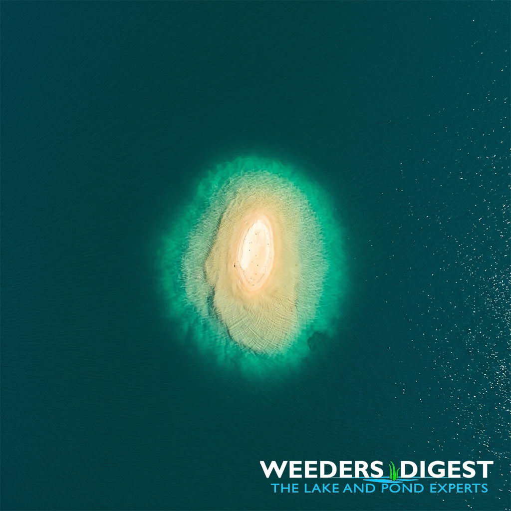
Why Does My Lake Have a Random Sandbar in the Middle of Nowhere?
 |

Summary:
It can be quite a shock when you are cruising across your favorite lake and suddenly realize the water beneath your boat has gone from twenty feet deep to just two. These mid-lake sandbars often feel like hidden islands appearing out of thin air, but they are actually the result of complex underwater "weather" patterns and geological history. Whether they are permanent features or shifting piles of sediment, they are a fascinating part of your lake's unique personality.
Most of the time, these shallow spots are created by the way water moves. Just like wind blows snow into drifts, underwater currents and waves push sand and silt along the lake bottom. When these currents hit an underwater obstacle or collide with another current, they lose energy and drop whatever they are carrying. Over decades, this "dropping" builds up a mound of sand that eventually reaches near the surface, creating that perfect spot for a mid-lake anchor-out.
In other cases, these sandbars are ancient leftovers from the last Ice Age. When massive glaciers melted away thousands of years ago, they didn't leave a perfectly flat hole; they left behind ridges of gravel and sand called moraines or eskers. What looks like a random shallow spot to you is actually the peak of a submerged "mountain" that was formed long before the lake even existed.
Understanding these features is key to enjoying your lake safely. Because water levels fluctuate and currents change with heavy storms, a sandbar that was deep enough to swim over last summer might be a propeller-ending hazard this year. Nature is constantly reshaping the floor of your lake, proving that the ground beneath the water is just as active as the surface above it.
The Science Behind It:
The formation of mid-lake sandbars, often classified as shoals or submerged bars, is primarily driven by the principles of hydrodynamics and sediment transport. According to research on lacustrine sedimentation, these features frequently materialize at "nodal points" where opposing wave energies or currents converge. When the orbital motion of water molecules—driven by wind-generated surface waves—reaches the lakebed, it creates shear stress. This stress entrains benthic sediments, moving them in the direction of the dominant current. When these currents encounter a decrease in velocity or a change in bathymetric pressure, the sediment is deposited through a process known as flocculation or gravitational settling.
Beyond contemporary wave action, many mid-lake shallow zones are relicts of glacial geomorphology. During the Pleistocene epoch, retreating ice sheets deposited unsorted glacial till and stratified drift in specific formations. Submerged ridges, known as kames or recessional moraines, represent points where the glacier paused or where meltwater streams deposited heavy loads of debris within ice-walled tunnels. These prehistoric structures remain as high-relief features on the lacustrine floor. Scientific studies published in journals like GSA Bulletin highlight how these bathymetric highs influence modern thermal stratification and nutrient cycling by disrupting the horizontal flow of the hypolimnion.
Furthermore, the persistence of a sandbar is often maintained by a feedback loop known as "morphodynamic equilibrium." As a sandbar grows, it causes waves to break prematurely, a process called wave shoaling. This breaking action dissipates energy, which in turn leads to more sediment deposition on the leeward side of the bar. This cycle allows the bar to maintain its elevation despite the erosive forces of the water. Research from the Journal of Great Lakes Research indicates that these features are not static; they migrate and reshape in response to seiches—long-standing waves in enclosed bodies of water—and seasonal changes in prevailing wind direction.
Ecologically, these mid-lake sandbars serve as critical "littoral islands" within the pelagic zone. The increased light penetration at these shallower depths allows for the colonization of submerged aquatic vegetation (SAV), which provides a unique habitat for macroinvertebrates and spawning fish. The interaction between the bathymetry and the water column creates localized upwelling, bringing nutrient-rich bottom water toward the surface, which can increase primary productivity in the immediate vicinity of the bar. This makes the sandbar not just a geological curiosity, but a focal point for the lake's biological activity.